Hamu- Iebe Gold Project
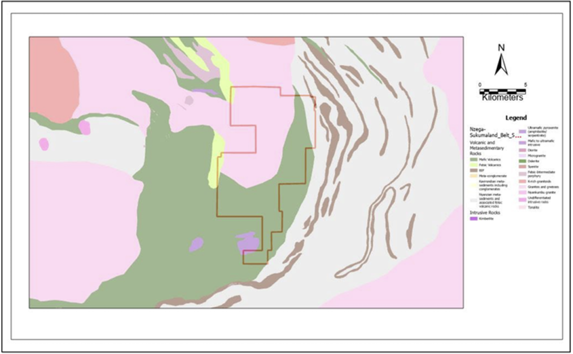
HAMU- IEBE Gold Project comprises of Prospecting license, 12334/2023, covering an area approximately 120.95 km2.
The Project is located within the Sukumaland Archaean Greenstone Belt which lies to the south of Lake Victoria.
The Sukumaland Belt consists of two intermittent, roughly oval shaped, E-W trending belts with an outer radius of between 80 and 140 km.
The central area is made up of mafic volcanics, and associated sediments of the Lower Nyanzian which host the Buck Reef and Bulyanhulu deposits.
The outer areas of the belt are dominated by the Upper Nyanzian consisting of banded iron formation (BIF), and intermediate to felsic volcanic and volcaniclastic units.
The western part of the belt, including the Geita area, is cut by regional scale, NE-trending quartz-gabbro dykes of Proterozoic age (Bukoban) and to a lesser extent by NNW-trending dolerite dykes of Karoo age.
Outcrops are limited and many parts of the tenement are covered by Mbuga soils and ferricrete except on the northern part where there are outcrops of granites. On the northern part, there are sands believed to be derived from the granites.
Gold mineralization in the region is preferentially hosted in narrow quartz veins (e.g., Bulyanhulu), granites (e.g., Buzwagi), greenstone-granite contacts, BIFs, cherts, and metavolcanics that have been affected by ductile and brittle deformation associated with shear zones.
The shears exploit fold axial planes and the contact between the supra-crustal and intrusive rocks. In 12334/2023 values of up to 115.7 ppb Au were obtained.
In this tenement, majority of the anomalies have also been found to align themselves with the regional horizontal U – shaped magnetic pattern running Northwest – Southeast from the proven multi-million ounces deposit’s special mining license of the Barrick’s Bulyanhulu Gold mine situated about 6 km from the project.